Solo traveler extraordinaire. Looking for vegan food.
Mount St. Helens 7.17.22
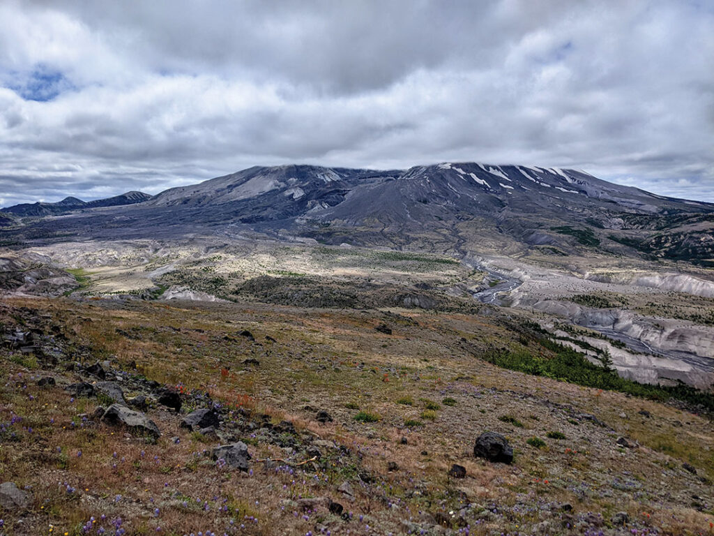
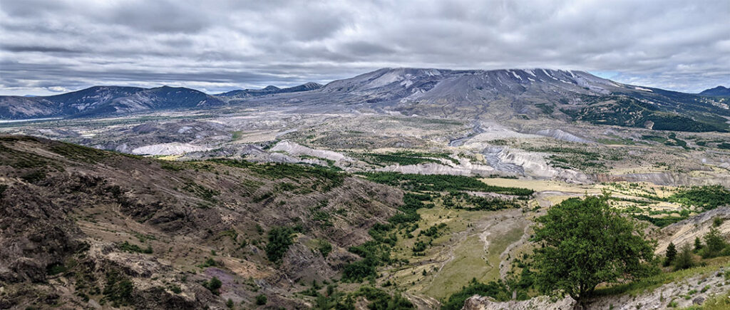
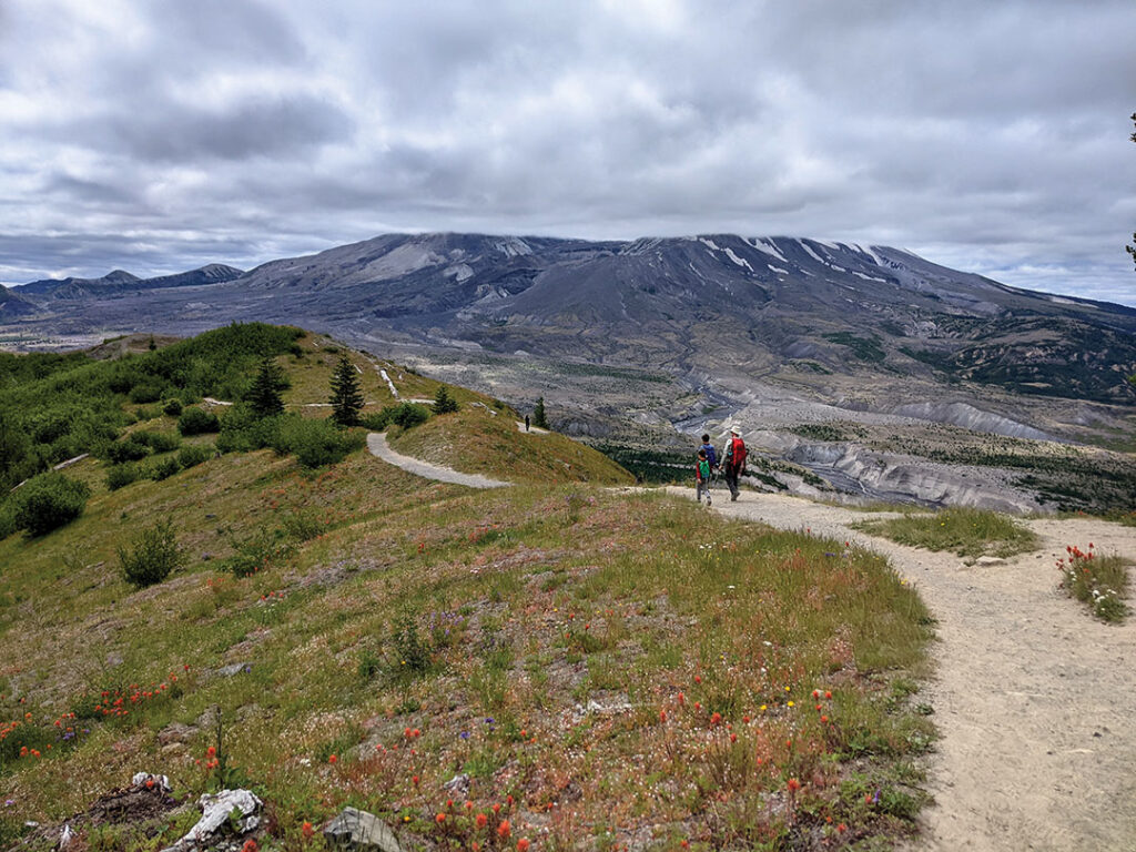
At 8:32 am on May 18, 1980, the north side of Mount St. Helens detached and slid into the valley below, the start of a volcanic eruption that covered the surrounding land in 150 feet of pumice and ash. Over 30 years later the scenery is still moon-scape-y. The scale doesn’t really sink in until you’re there in person.
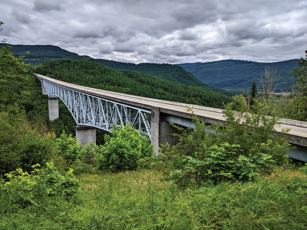
The unexpected scale is also what caused so much loss of life. Authorities knew the volcano was going to explode, and they created a restricted zone around the base of the mountain to keep people away. But instead of going straight up, the eruption went sideways and spread for miles outside the restricted zone. (Of the 57 people who died, 53 were in a “safe” area.) This is the Hoffstadt Creek Bridge on the edge of the blast zone. (The area has been manually re-forested.) It’s 14.8 miles from the Mount St. Helens crater.
Part of the reason the landslide was so devastating was that Mount St. Helens was covered in snow and ice. The heat from the blast liquefied the snow, which mixed with the dirt to make a flash flood of mud that wiped out everything (trees, cars, houses, bridges).
Around noon a super-hot cloud of rock, gas, and ash sped down the mountain at speeds that overtook cars, welded clothes to people, and combed the forest flat. One of the residents who stayed in the danger zone thought he would be able to see bright orange lava coming and easily avoid it (he died), but Mount St. Helens was a dacite eruption rather than a basalt eruption (basalt makes the molten syrup-like lava you see in Hawaii). Dacite eruptions create a lot more pressure because of trapped gas, making them more explosive.
Even though the forest is gone, there’s wildflowers everywhere.
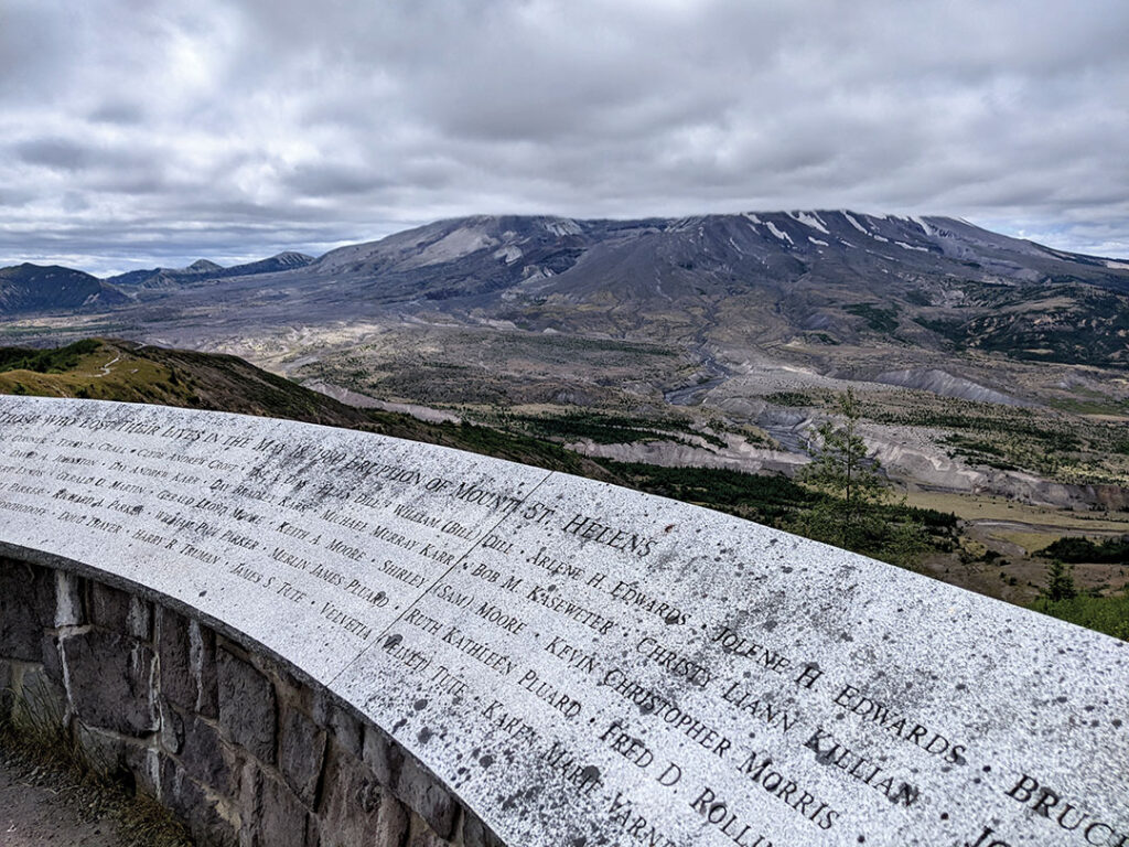
Although there is a “Mount St. Helens Visitor Center,” it’s sort of far from the mountain. So this is the Johnston Ridge Observatory, which is about as close as you can get. It’s also the starting point for what looked like some serious hikes (everyone had hats, backpacks, and poles).